The Architect
George E Clare of Harrow (1868 – 1953) ARIBA designed all the original houses. His practice was at 1 West Street, Finsbury Circus in London. He also worked on buildings at the famous 1920s Crittall Village at Silver End in Essex.
He was already 54 when he was commissioned by the Sykes to design Richings Park and was thus a mature architect with a clear eye and considerable experience. Individual private commissions for single houses had resulted in the existence of examples of his work in nearly every English county. There were also several in Ireland.
After a five year apprenticeship in Norwich, he established his own practice in Chelmsford in 1897 (at 29). He branched out to London and Westcliffe-On-Sea but his health required him to confine his attention to Chelmsford. In 1908 he moved to Norwich, followed by a brief spell in Leicester but by 1914 he was settled in Harrow-on-the-Hill. There he was engaged by the Sykes.
He had won a 1st prize for a Police building in Chelmsford but his main interest and work seems to have been in estate development and the design of economical and labour-saving houses. This had included work in Wembley Garden Suburb, Moor Park Estate (Herts.), Chalkwell Hall Estate (Westcliffe-On-Sea) and Letchworth Garden City.
He regarded the Richings Park commission from the Sykes as his most important work. In later years, after a spell in 1942 in Croydon, he moved to Petersfield (Hants) in 1944, where he remained until his death. He remained at work in his office up to the evening before being taken ill, two months before his death on 8th January 1953.
Clare developed and patented large, kiln-fired building blocks “Clare’s Blocks” to facilitate rapid construction of houses and the houses in Richings Park were built of these. These blocks were the size of 6 bricks and had keys top and bottom and contained channels to create a cavity wall of sorts. They were intended to be covered with plaster rendering or pebble dashing.
Clare claimed they were impermeable and at the Richings Park Stand at the Ideal Home Exhibition (1924) a block was displayed with a jet of water continuously playing against it – to show no water penetration.
In 1900 Clare published a booklet about topic entitled “Ideal Homes for the People” – Cellular Block Construction (C.B.C). It covered quite a lot of ground and included elevations and plans of “Houses suitable for the farmer; … Bungalows for young couples … old people’s retirement … semis for farm workers/small holders … or Farmer’s/Bailiff’s Cottages”.
The commission at Richings Park seems to have enabled him to expand his horizons. The booklet had several editions, the last being in 1951, when he was aged 83; by then it was called “Ideal Homes in Rural Areas”.
Clare’s booklet also states that the blocks were tested and approved in 1917 by the Ministry of Health and received favourable comment in the Architect’s Journal (for 20 April 1921) which drew attention to the use of similar blocks in the USA and France, already at that time in use “for nearly 20 years”.
A list is given of district councils who had adopted the blocks for economy and speedy erection: Harrow, Wembley, Eton, Weston-Super-Mare, Leicester, Birmingham, Croydon and many others. Locally, later generations of residents of Richings Park do not perceive Clare’s blocks in the same way as their creator saw them!
Clare’s designs acknowledged the advent of the motorcar with far more foresight than was common at the time. Almost every house was provided with a garage or the space in which to build one later. Since all but a few houses were detached, this meant that each had an average frontage of 40-45 feet to the street.
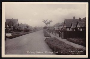
With gardens at the rear of 200ft (average) each household had plenty of family space and, as gardens matured, the prospect of not being over-looked. The streets were of some 20 feet width (carriage way) and provided with tree planted verges and good footways; houses were set well back from the street – 40ft being the average (much further in a section of Somerset Way and of Wellesley Avenue where verges became lawns).
The verges were often planted with ornamental trees with the exception of Wellesley Avenue which was planted with lime trees. This was all to create a desirable spacious development in which to bring up a family; a model “Garden Village” of family homes, affordable by post World War One “Pooters”; professional men of average means seeking the much vaunted “homes fit for heroes”.
Original purchasers selected their design of house from 12 designs for detached, semi-detached and bungalows and were given some choice in the site of the design they had selected. A variety of individual modifications were also available. Subsequently the designs were located and presented, where they were, to prospective purchasers. The streets, however, are not entirely composed of a universal medley.
Each street deliberately has its own character:
- In Thorney Lane variations on the type “L” house predominate.
- Bathurst Walk shows more semi-detached houses.
- Wellesley Avenue and Somerset Way have most bungalows and also most of the “K” variations.
- Variations (of any kind) on the type “K” house do not occur in Bathurst Walk, or Thorney Lane.
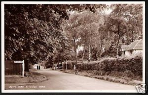
- North Park and Old Slade Lane are characterised by houses of wider elevation and by larger plots of ground.
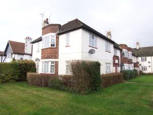
The characteristics of Clare’s designs are apparent in the houses creating an harmonious and attractive appearance. These features included the proportions, the gable ends and roof lines, the use of the barge-boards and soffits, fenestration and chimney stacks.
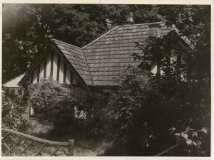
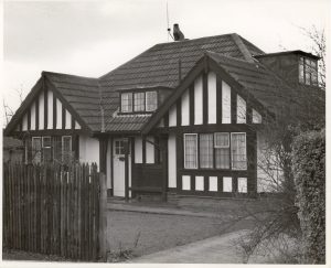
In the 1920s Clare had acquired timbers capable of structural use rather than just as pseudo-Tudor appliqué in the gable-ends and front elevations generally seen. It seems that he only had enough material available to devise just 2 houses where the timbers were an integral part of the structure. So it was logical to place them facing each other at a focal point a short way down the main avenue (Wellesley Avenue) from the railway station.
At that time this was the only road to be uniformly planted with lime trees. It is not thought that these two houses (Tudor Cottage and xxxxxx) were custom built, rather that circumstances meant that their “Tudor” character would be in keeping with the new development.
Promotion of the Richings Park Estate
Great assiduity was shown over this aspect of the affairs of the development by the Sykes brothers. The advertising/promotion for Richings Park was detailed and recurring. Rental on a no-deposit basis was available as well as direct sales.
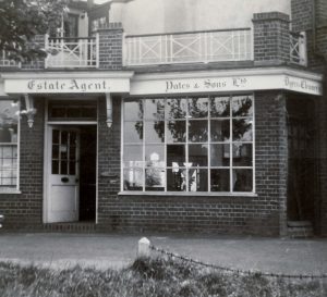
Their promotion extended to eight show houses fully furnished, with advisers on hand for floors/carpets, upholstery and curtains, all arranged by Messrs John Perring (then of High Street, Putney “and branches” – there was one in Uxbridge). All the current modern conveniences were offered; everything shown was priced; “easy terms” made it possible to buy everything, there and then, at the time of viewing.
Friend Sykes had managed to secure the services of the noted London firm of Knight, Frank and Rutley, Hanover Square (Knight Frank, today) to promote their development in Richings Park.
They published the first brochure for the new development which included Clare’s drawings and plans of the houses. Oddly Knight Frank’s archive contains no mention of Richings Park except for one photo of Richings Lodge.
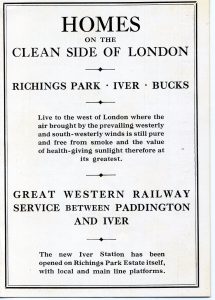
Some 10 months before Iver Railway Station was opened in December 1924, the GWR was promoting Richings Park. The advertisement in the Great Western Railway Magazine for February 1924 was placed by Knight, Frank and Rutley and was accompanied by an editorial article listing the promotional features: parkland, gravel uplift, fresh milk from its own farm and also the space for each family.
It also appears that the Editor had visited and is quoted as being “very favourably impressed by the substantial nature of the buildings and the quality of materials and workmanship generally. The whole of the buildings contract has been let to Messrs Limpus & Son, Kingston on Thames, who have a high reputation to maintain.“
The Richings Park Estate had a stand at several Ideal Home Exhibitions. The late Mrs Betty Wyatt, newly married, recalled choosing the bungalow at 42 Wellesley Avenue, at the 1924 exhibition. As was advertised at the time, they were able to alter some of the internal arrangements to suit their requirements before the bungalow was built for them.
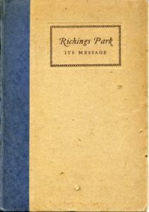
The Estate Company published two promotional books of its own. These were 6″ x 8″ hardbacks of 46 pages each. Both were excellently produced and lavishly illustrated. The first published by the private Richings Park Company (of 1926) in 1927 was called “Richings Park – Its Message” and on the fly leaf: “Houses Without Deposit – Being a New Way of Home-Building Without Financial Anxiety“. Great care was taken to explain in careful, simple detail the financial arrangements. Also included was information about:
- the location;
- the benefit of clean air;
- the availability of milk from a pedigree Friesian herd from the Estate’s own model dairy;
- the convenience of houses from a woman’s point of view and from the man’s;
- the rates and charges;
- the trains – their costs and travelling times to London and through to the City (through trains then!);
- the local and nearby shops, sports facilities and places of interest.
The drama and choral societies were already in existence. Educational, medical and church facilities were all mentioned. There were photos (2 in colour) of furnished rooms and of a kitchen – electric cooker provided.
Much was made of Clare’s houses and his designs “(which are) the property of the Riching’s Park Estate Ltd” (i.e., they were exclusive) and of Clare’s patent blocks – new technology providing insulation both against cold and heat and so on. The book was well illustrated with photos of houses. There was also a wishful thinking centrefold in colour – Tudor Court.
The second promotional book was published by the Richings Park (1928) Co, Ltd. and can only have been 1½ years after the first. The emphasis was now on what was going to happen. Titled “A Country House Near London” it took up from the first book and pushed further the idea of a spacious, Arcadian suburbia.
The main purpose was “An account of the Northumberland and Slade Estates at Iver in the County of Buckinghamshire“. These were to have been developed through the park of the mansion and on from Old Slade Lane, with a great emphasis on tennis courts. There were ten full-page parkland photos and the aerial photo from an earlier period. Clare
house designs were illustrated as artist’s impressions as none was yet built, but the detailed specifications were provided. The text was a shortened summary of that in the first book but now included reference to the Estate’s “own theatre” (the Plaza Cinema) and its “own boys” Prep. School.
On Saturday 15 Sep 1928 an article appeared in the Daily Telegraph on a page headed: “The Home and Women’s Interests“. There is a 4¾” x 6″ box-advert for “Richings Park Estate” headed by a drawing of a “K” type house in Tudor finish.
Below the promotional text readers were urged to “Write for the beautiful illustrated book of the estate to” RP (1928) Ltd at the Iver address. In the article on the page 5½ column inches were devoted to Richings Park and 2½ inches to Welwyn Garden City!
At the top of the article was a photo of a “typical house” – never mind that the picture shows the view from the park of No. 39 Old Slade Lane (still the school at that time) and the only house of its kind!
The Builders
Very little is known about those who actually built Richings Park. Several companies seem to have been involved, possibly at different times. Messrs Limpus & son of Kingston on Thames were mentioned in early promotional material and provided the doors and windows for the houses; Gradwells were mentioned by early residents and Rhys J. Rees was involved in 1930.
Roads/Tracks
Thorney Lane, running all the way from St Peter’s Church in Iver through Richings Park to Sutton, Horsemoor Green and Langley Marish and connecting with the road to Thorney Mill, has probably existed for more than a thousand years. For much of that time its use was to connect the manor with its more remote farms and the rich parish land to the south, but
it became more important when Richings Park became an estate in its own right. At times in the past, a section was also known as Richings Lane. Perhaps not surprisingly some of the modern Richings Park roads have their origins in some of the old tracks to fields and homesteads, which were themselves influenced by ancient long gone features. The Sykes brothers tapped into this vein of history when naming the roads of the Estate.
The large area of Thorney Wood dictated the course of the roads with those to the west of Thorney and Colnbrook curving round the wood. Originally most travel was on foot on tracks that lead from Colnbrook to Iver passing along Dole Slade, then across the Ridgeway to Iver.
Changes to the roads in Richings Park were made by John Sullivan who bought the estate in 1786. A sketch map from the conveyance dated 1792 shows the original roads and the changes were made in 1795 resulting in the formation of the present Old Slade Lane as shown.
North Park was the northern boundary of the park ground of Richings Manor formed from the old track to Sutton and Parlunt during John Sullivan’s changes. More recently it was a track leading to Market Lane and Meadfield Road and Langley.
This route was lost during the war as the Hawker airfield extended right through. At that time the route from Richings Park to Langley was via North Park which only extended just beyond the drive up to Home Farm, along a dogleg through Home Wood (which extended between Home Farm and Sutton Lane) and out into Sutton Lane alongside the farmyard. Thence to the A4 and back to Langley.
In more recent times the A4 and A40 became major roads and source of increasing traffic and then came the motorways – the M4 in 1963 and M25 in 1986. In addition to the resulting pounding traffic, these roads have bounded and carved up our locality so that it not easy to image how free, open and peaceful it used to be.
The present street names were an attempt by the Sykes brothers to preserve what they felt to be some of the important historical connections: Bathurst Walk, Somerset Way, Wellesley Avenue, The Poynings.
The new straight stretch of road, cutting off St Leonard’s Walk (the original Thorney Lane) was briefly known as Hache Way. The early names of Syke Ings and Syke Cluan were Northumberland Avenue and The Earl’s Walk.
One early brochure mentions and has photographs of Fitz-Payne Avenue and Beauchamp Avenue. The new development of Northumberland Walk (off Syke Cluan) maintains this tradition.
Syke (sike) is the Anglo-Saxon word for a ditch or water course and still in use in Yorkshire; an ings was a meadow next to a syke (in Scotland a cluan). Much of the land was originally meadow prior to the building of the estate.
The first residents of Richings Park recalled a small stream in a ditch running along what was Syke Cluan before it was made up. The co-incidence with the name of the Sykes brothers was well taken.
Building after the Sykes
51 – 61 Syke Ings and 46 – 54 Syke Cluan: These house were built around 1936-37. They stand back to back at the point where these two roads begin to converge. This is where the 30m contour line swings east to run along Richings Way to the Tower arms.
Their site used to be a small, pre-Richings Park Company gravel pit. Here the Sykes brothers intended to build Tudor Court stating “it will be completed next year” in their promotional hardback book Richings Park – its message – houses without deposit published by the Estate Company in 1927.
A double page, colour centre-spread gave a perhaps fanciful artist’s impression by Clare of what this would look like: there was to be a triangle of 4-8 house Tudor terraces and a lake (with island) in the middle. It is not clear how it would all have fitted in!
Instead the gravel pit was filled in and houses now on this site had to wait until the ground had settled enough to be built on. Perfectly harmonious and cement-rendered they have, as a group, their own character – all are different. Caught up in the receivership, it is not known how far they are attributable to Clare.
North Park – North side. The ten houses here were mostly built by a local builder, Farr, on land conveyed to him in October 1927 by Purser of Sutton Farm who had purchased his tenancy from the Meekings Trust in 1922. These are of more standard suburban designs for detached and semis with render and or brick.
Bathurst Walk West. In 1939/41 the builder Warren, of Uxbridge was developing in-fill sites at the far end of Bathurst Walk. The street came to a dead end in the middle of a field. This was Purser’s land (Sutton Farm) stretching all the way from North Park to the railway which Warren had bought in 1938.
A significant development was planned to utilise a proposed new orbital road from Colnbrook (Brand’s Hill) to Iver Heath (Wood Lane). Post war, the demands of the green belt did not allow this and only the completion of the cul-de-sac was built comprising more standard suburban detached and semidetached houses with render or brick finish. Warren sold the rest of the land to Boyer.
Buckfield Court. This was built in 1938/39 by Tyson Chambers of Slough who also built Slough Town Hall and the now demolished Girls’ High School.
Back lane behind the shops/Bathurst Close. This narrow lane runs at the back of the shops from Syke Ings to Bathurst Walk, being intersected by Wellesley Avenue. Its original function was presumably to serve as a rear access for the shops in Bathurst Walk but its status regarding access, rights of way and ownership is not known.
It is possible that a mistake was made in the drawing up of the various conveyance documents when the company was created and it was simply left off in a clerical error. It has been privately surfaced at various recent times and some drainage installed for the convenience of those accessing it.
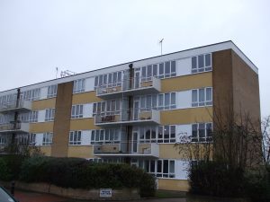
At times lorries/vans/cars associated with the businesses are parked in the lane causing inconvenience for the other residents. Mr Roberts conveyed the land owned by Mr Norrish of Chiswick to the developer of the 2 blocks of maisonettes 20 to 26A Bathurst Walk (around 1952/3) which were completed in 1959.
During this process it was not possible to define any rights relative to access from the lane at the rear beyond “customary rights of access“. The garages for the maisonettes were built to access onto the lane.
There was originally intended to be a complete row of shops along Bathurst Walk on this land to join up with that at 18 Bathurst Walk but these did not get built.
At about this time (1959) some of the land on which Bathurst Close was built was also sold by Mr Norrish. The rest was acquired from the back gardens of the houses in Bathurst Walk and Thorney Lane South. Prior to this the land had been a waste area comprising a row of lock up garages, a circular track round a gravel dump and a decrepit builder’s shed in the corner closest Bathurst Walk.
The 1st Richings Park Scout hut was located here during part of the war. Bathurst Close became a truly private road which is maintained by the residents.
Old Slade Lane south. This was originally an old farm track south from Old Slade to Colnbrook passing close to Tan House farm. From before the Sykes and for a time after their arrival the address of Old Slade Farm was Colnbrook. It then became a Richings Park Estate road to its gravel pit (which eventually became a nature reserve and then reworked as a gravel pit).
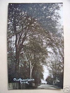
Only a few plots had been developed when Boyers acquired the remnants of the Estate in 1938. Plots for post war houses were conveyed to individuals by Boyer.
The Poynings. This street was partially developed by 1928 and it is rumoured that Eric Sykes lived in No 11. Further development was undertaken during the receivorship and the road was completed with a variety of brick houses of modest proportions by the builder, Cotton (of Iver Heath?) post 1945.
The Ridings. This cul-de-sac of 7 pairs of plain, rendered semi-detached houses (some thatched) was another entirely separate, private development by Rhys J. Rees, one of the builders employed by the Richings Park Company. The land was conveyed by R.P. (1928) Ltd to the builder, to develop as he wished, in September 1930.
At that time the collapse was approaching and the cash flow was difficult. It may be that this was payment in kind. The designs of these houses were later replicated in other areas – The Poynings, Syke Ings and Skye Cluan. Maybe they were one of Clare’s ideas for houses for agricultural workers.
In these roads in some cases it appears that latterly properties were conveyed with ownership up to the middle of the road rather than the front boundary. It was the Richings Park Company practice to state quite clearly that land conveyance stopped at the frontage to the street, and it was part of the promotion that the properties would front roadways that would be brought up to specification for adoption by the highway authorities.
These three roads were in the process of being brought up to specification in 1931 for adoption by Eton Rural District Council and caught in that process, they seem not to have been part of the assets in the control of the Official Receiver.
So, when land nearby was sold off to Boyer Sand and Gravel in 1938, the land occupied by these roads was specifically excluded. Mr Leno of Farr Bedford (Agents for Boyers) when approached by the Richings Park Residents’ Association about the matter in 1982 was able to provide a copy plan of the 1938 conveyance to Boyers to show that the land on which these roads stand was specifically not conveyed to Boyers. Thus they became ownerless.
When the accommodation bridge was built to take the lane over the M4 and a deviation of its line was necessary, great efforts were made to persuade the Department of Transport to incorporate the remaining 550 yards back to Old Slade Farm but to no avail.
The station track
When the Estate was built there remained a wide track running from the top of Wellesley Avenue to Thorney Lane South, behind the then Plaza cinema and the houses fronting Bathurst Walk. This track appeared on old maps and pre-dated the Estate and possibly the railway. It ran alongside, but was separate from, the station path which is on railway land.
It seems possible that for some unknown reason, the Sykes brothers retained ownership of this track, along with other parcels of land, when they set up their private company in 1926. Mr Roberts and others recollect that this was one of the parcels of land offered for auction after the company went into receivership. It is thought that no buyer was found.
From the 1930s onwards it remained a badly rutted, potholed gravel track used to access the station from Thorney Lane South and for parking cars for commuters using the station.
After the war the Plaza was sold to a Mr Norrish who sold it in 1959 and Wellesley Court was subsequently built on the site. The sale included no part of the station track and old photographs show the wall between the two still much the same then as now.
In the early 1980s the householders along that part of Bathurst Walk were concerned about the noise they might suffer if the proposed park and ride/motorway services/new station development were to go ahead on the land north of Iver station.
As a result of discussions with the householders and South Bucks District Council, BR agreed to plant a row of cypress trees 1 metre beyond their boundary in June 1984 and cleared/levelled a 2 metre strip in order to do so. They then made up and tarmacked the track up to the ticket office, and have resurfaced it once since then, around 1992. It seems that the extensions of some of the gardens by various lengths across the track took place after this time.